Here is a view from the middle of town looking back towards the direction of Chendgu [east?].
Sunday, May 29, 2005
Anjue Si monastery, Kangding

This is one of the main monasteries in Kangding, and is right in the middle of town. It also runs a guesthouse [The Black Tent Hotel] and coffee bar!
Buddha figure at Anjue Si monastery, Kangding

The serene face of a Buddha figure seen in Kangding before my departure to Jiulong.

A river runs through it ...

The mighty Kangding river that runs smack through the middle of town and takes no prisoners whenever there is a flood.
Kangding

Kangding is the hill town where many of the interesting treks in Joseph Rock's footsteps start from. Minya Konka, the Yalong Canyon and even the Konkaling ranges all pass through here. In Rock's day it was known as Tatsienlu, a sinicised form of the Tibetan Darsendo.
Monday, May 23, 2005
Coming up: Mongdong [猛董] and the Yalong Canyon [雅砻江]

Stay tuned for the full account of my recent trip to the Yalong canyon and the beautiful mountain of Maidi Gangga [麦地贡嘎, Muti Konka]. Joseph Rock described it as a "scenic wonder of the world". Nobody has seen it since he went there in 1927. Except me.
Friday, May 20, 2005
"Yeti temple" [野人庙] in Tibetan Sichuan

These Pumi people are building a temple to honour the "wild man" (yeren [野人] or yeti) that is said to frequent this remote mountain district near Jiulong. It's a day's drive south of Kangding.
Yeren Miao [Wild Man Temple], near Jiulong in Sichuan
![Yeren Miao [Wild Man Temple, 野人庙] near Jiulong in Sichuan](https://farm1.staticflickr.com/10/14319136_c86a1396b4_o.jpg)
About an hour's drive and a 40 minute walk up a bumpy farm track southeast of town, this small temple is built in a cave, half way up a cliff. Local legend has it that the local people knew of the cave and its spring of "holy water" many hundreds of years ago, and visited it to pray for a good harvest. Then one day some primitive statues and simple structures appeared overnight. No one knew who did it, and it was attributed to the "Wild Man" or Yeren - the Chinese term for yeti. Another version I've heard is that the term wild man" was used to describe an unkempt hermit who lived in the cave, meditating for many years and whose personal hygiene and apparel - and perhaps his attitude - were somewhat, well, wild. You can now see the yeti's big footprints and hand [paw?] prints, enshrined in the small temple, reached by a short but steep walk up the cliff path. There is a fancy new temple being built at the foot of the cliff - go past it and look for the track branching off to the left, over a stone bridge.
If you want to make your own way to the temple, take the left fork from the main street just after the public toilets. You can't miss the smell!
If you want to make your own way to the temple, take the left fork from the main street just after the public toilets. You can't miss the smell!


Cave shrine with yeti footprint

This shrine contains what is said to tbe the footrpint [or pawprint?] of the "wild man" or Chinese yeti that is venerated at the temple. See for yourself.


Yeti's eye view - from the Yeren Miao

Looking back north west towards Jiulong. In the distance on the right is the new temple.

View of the temple from below.

The newly built temple below the old cave shrine on the cliff.

Approaching the Wild man temple from the valley out of Jiulong.

Yeren Miao from in front. The temple is built into a cave in a cliff, and the cave has a holy water spring in it.

The "Yeti Temple".

Saturday, May 14, 2005
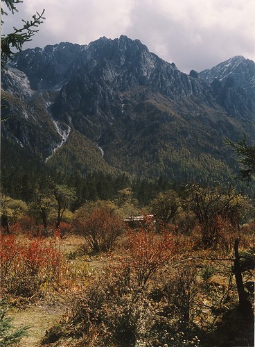
Wuxu Hai (伍须海), near Jiulong (九龙) in Sichuan, 2004
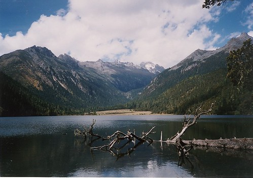
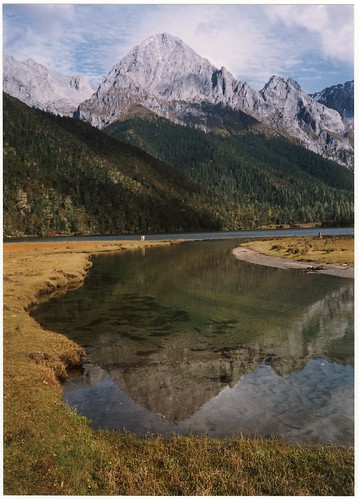
Wuxu lake is a pristine alpine lake about a day's ride on a bus south from Kangding. It is surrounded by mountains of about 18-20,000 feet high and there are a few Tibetan herders living around it. It is a beautiful and unspoilt spot, but for how much longer remains to be seen. This is the view from the near shore, a short walk from the rough and ready "visitor centre" with its restaurant and log cabin accomodation.
If you want to find out more, there is my Jiulong travel guide summary hosted at the fabulous Chinabackpacker:
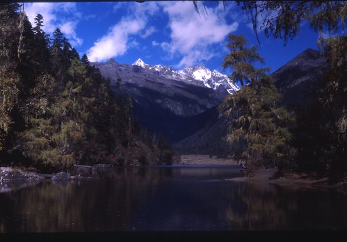
Wuxu Hai (伍须海) - northern shore
On the far shore of the lake is a smallish grassy flat with a couple of Tibetan log cabins. This is the view from there towards the "Twelve Daughters" range of peaks.
Wuxu Hai views

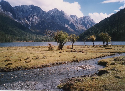
Paddock in front of the lake.

The "hotel" and restaurant.

Along the road.

Lichen on trees.

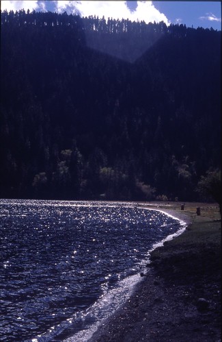
The near shore. Clear water.

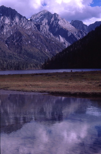
One of the peaks surrounding Wuxu Hai.

A stream that runs out of the lake.

"Twelve daughters" mountains (十二姑娘), Wuxu Hai, near Jiulong, Sichuan
In Chinese these peaks are known as the "Shi er guniang shan"

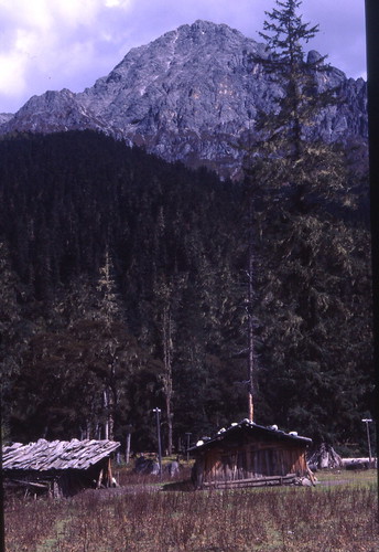
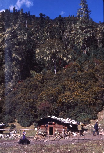
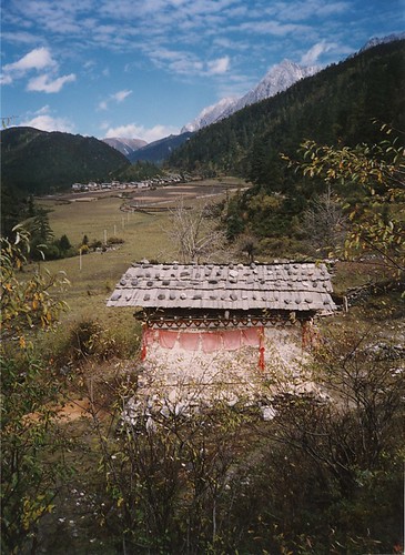
Hut below Wuxu Hai
On the road up to Wuxu Hai from the lower village you get some tantalising glimpses of peaks in the distance.
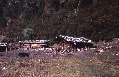
Lower Wuxu village
About 5km below Wuxu Hai there is a small Tibetan village known as lower Wuxu. There is a small store here and some holiday cabins being built.

At lower Wuxi village we tried to hitch a lift back to Jiulong but there was no traffic. In the end we paid a couple of local guys to take u s on the back of their motorbikes - one of the scariest and most foolish journeys I've ever taken. It's hard to keep your balance on a motorbike when you have a 15kg backpack on and you're riding over potholes without a helmet.

Looking up at one of the "12 daughters"
Wuxu Hai child labour
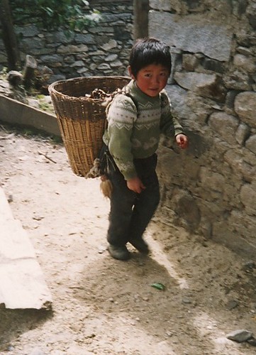
In the village below Wuxu Hai I snapped this young kid already at work in the fields with a basket full of corn stalks on his back.
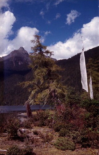
Rock painting near Wuxu Hai
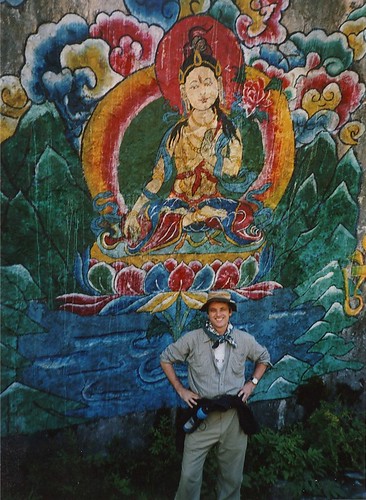
About 3km down the hill from Wuxu Hai in the forest by the roadside is a huge rock covered with Buddhist deity paintings and festooned with white scarves and prayer flags. It is circled by devout pilgrims and cheesy looking tourists from Leeds, like the one above.
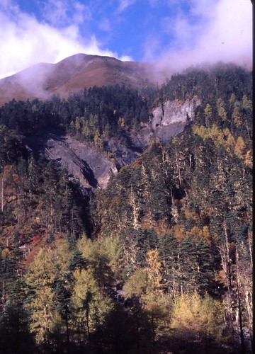
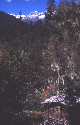
"Black limestone peak"
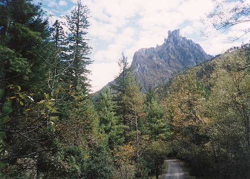
On Joseph Rock's hand-drawn map of the area, he has marked on some "black limestone peaks". Sure enough, on the 20km dirt track up from Jiulong, here they are.
Subscribe to:
Posts (Atom)